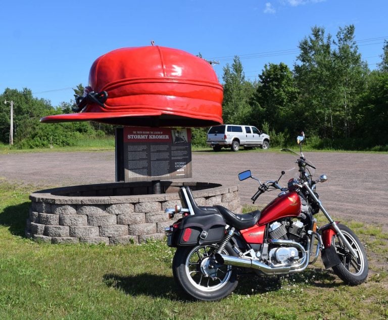
The legend of the Stormy Kromer cap didn’t begin in Ironwood, MI, but it continues there to this day.
0:00
▶
North for the Fourth 2017: Motorcycle Touring in Michigan
Last year around this time, we shared ideas for touring destinations on the south shore of Lake Superior, based on day-trip touring during a Fourth of July vacation. We enjoyed that so much we thought we’d do it again and share some new sights we took in along the way.
My long-time riding buddy, Dean Massoglia checks out the area at the South Boundary Road bridge over the Presque Isle River, his Honda VTX1300 in the foreground.
Located 15 miles west of Ontonagon, Mich., in the spectacular Upper Peninsula, the park covers 60,000 acres of rolling, rugged pine and hemlock forest, including 90 miles of hiking trails and about 35,000 acres of towering virgin timber. That tract is federally recognized as a National Natural Landmark.
The Porcupine Mountains—known locally as “the Porkies”—are a 12-mile-long escarpment that runs parallel to the south shore of Lake Superior for about one and a half miles.
My long-time riding buddy, Dean Massoglia, who lives in the U.P., joined me on the meandering route we took through the Porkies. His choice of ride? A Honda VTX1300.
A great way to get there by motorcycle is to take Gogebic County Highway 519 on the western end of the U.P., from Wakefield, Mich. In about 19 miles, that takes you to the Presque Isle River portion of the park.
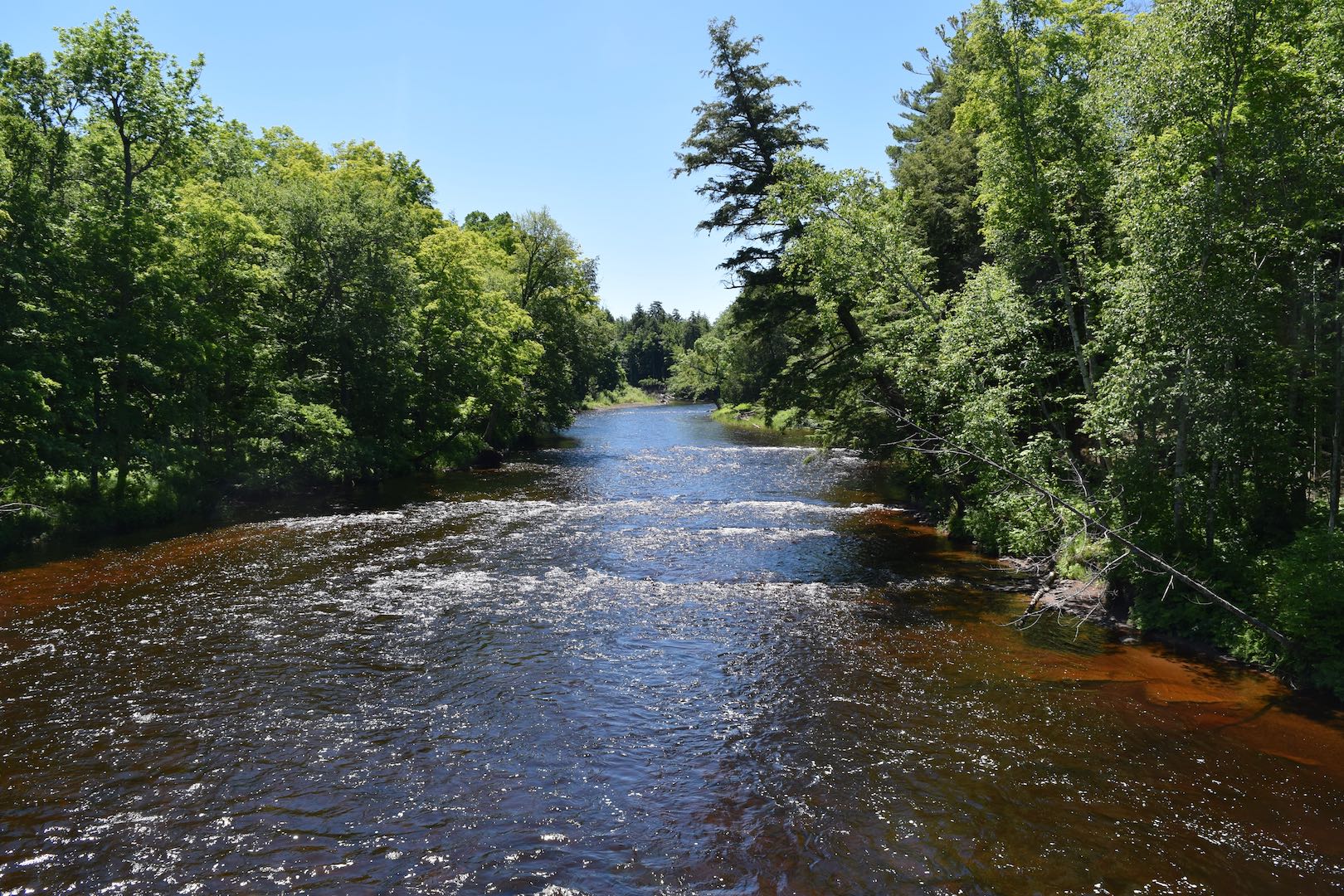
Before its rocky descent to Lake Superior, the Presque Isle River looks leisurely and inviting…
The Presque Isle riverbed varies from a wide, relatively shallow, mellow river back away from the descent to Lake Superior to a narrow, wild, roaring beast in the falls that form as the river drops down to its confluence with Lake Superior.
These views of the Presque Isle River and Lake Superior are from the hiking trail that extends east from a small parking area just off the park road past the park entry office. Further on, there is the Presque Isle Campground, which has 50 campsites and a stairway down to the lakeshore from its east end.
From CTH 519, the South Boundary Road meanders for 33 miles northeast through the park until it ends at highway M-107. There is very little to no shoulder on much of the South Boundary Road, with vegetation coming right up to the road, plus plenty of curves and changes in elevation, so visibility off the road is limited.
Those factors, combined with a generous population of black bear, deer, coyotes, with maybe an occasional gray wolf or even a moose and keeping your speed down and your alertness up are good things to do. Turn west on M-107 for another seven miles to reach the parking area for Lake of the Clouds.
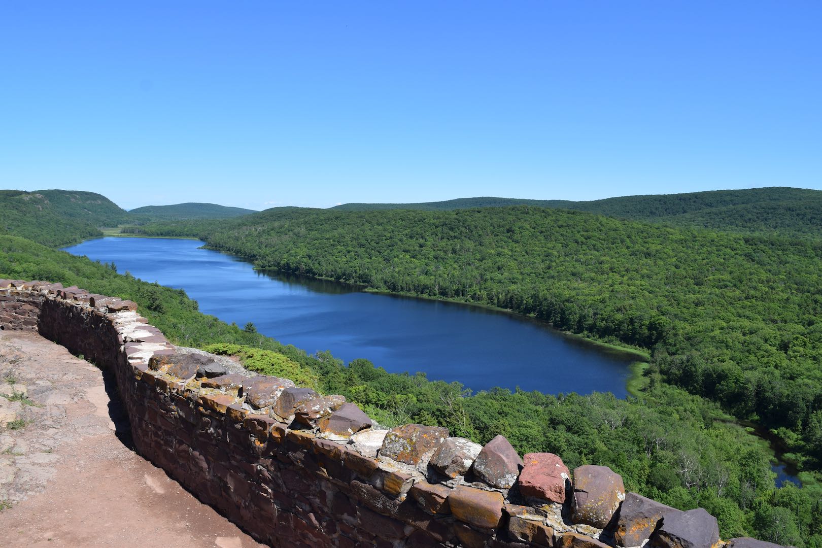
If the name evokes images of otherworldly beauty and a spectacular range, you understand the place. Apart from the parking lot behind you and the viewing areas provided where you stand, the view extends more than 25 miles in three directions. Except for the Copper Peak Ski Flying tower, just visible about 20 miles to the south, the forest shows no sign of human habitation or activity.
Heading back east along M-107 into Silver City, we picked up M-64 south to Bergland, then turned west on M-28 back to Wakefield, which also takes you into the Ottawa National Forest.
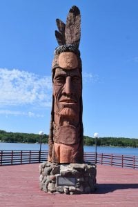
The statue of Nee-Gaw-Nee-Gaw-Bow was carved by Peter Wolf Toth from a single pine log from the Ottawa National Forest.
Back in Wakefield, right next to the city’s beautiful Sunday Lake, at the Wakefield Visitor Center is the striking statue of Nee-Gaw-Nee-Gaw-Bow (Leading Man), carved by Peter Wolf Toth, dedicated in 1988.
Toth has donated an original Indian carving to each of the 50 states and provinces in Canada as the 59th statue on his epic “Trail of Whispering Giants,” which he created from 1971 to 1988. The work in Wakefield honors the Chippewa (Ojibwe or Anishinabe) tribe, which is prominent in the area and its history. The statue was carved from a single pine log donated by the Ottawa National Forest.
No trip to the U.P. is complete without visiting the Stormy Kromer monument and reading up on the Stormy Kromer story.
The true story of the Stormy Kromer hat dates back to 1903, when George “Stormy” Kromer realized the need for ear flaps to ward off the cold and a short brim to cheat the wind. With the help of his wife working the needle and thread, they came up with a hat design that came into such demand that a company was formed. By 1918, large-scale manufacturing was underway in Milwaukee.
As time went by, the company aged as did its founder, and eventually Ironwood, Michigan businessman and owner of Jacquart Fabric Products, Bob Jacquart, acquired the manufacturing rights and moved the operation north. Since 2001, the storied Stormy Kromer caps have been manufactured in Ironwood; a fitting place for the manufacture of a cap made to blunt the cold and snow because in winter, Ironwood can get plenty of it.
North for the Fourth 2017: Photo Gallery
The legend of the Stormy Kromer cap didn’t begin in Ironwood, MI, but it continues there to this day.
My long-time riding buddy, Dean Massoglia checks out the area at the South Boundary Road bridge over the Presque Isle River, his Honda VTX 1300 in the foreground.
Before its rocky descent to Lake Superior, the Presque Isle River looks leisurely and inviting…
After it begins its descent, the Presque River roars through a narrow gorge on its way to the lake.
The view from hundreds of feet above Lake of the Clouds is magnificent.
The statue of Nee-Gaw-Nee-Gaw-Bow was carved by Peter Wolf Toth from a single pine log from the Ottawa National Forest.
Hello and welcome again to the Motos and Friends Podcast. This episode is brought to you by Leod Escapes.
* * * * *
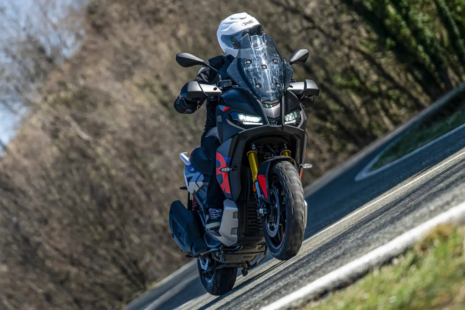
Aprilia is bringing a scooter to North America, and it’s one designed to appeal to adventure motorcyclists. The SR GT 400 is a mid-size scooter built around a steel motorcycle-style frame, a 399cc single, and off-road-ready hardware. It reaches US dealers as soon as this month. Don Williams and Kelly Callan spent some time riding the Aprilia and were surprised by what they discovered. Is this a real motorcycle or just a good-looking urban scooter?
* * * * *
Cat McLeod is founder and owner of Leod Escapes, the ultimate tour company for sport-minded motorcycle riders. Cat talks to us this segment about some of his amazing European experiences and tours that include of course, riding some amazing MotoGP tracks on new BMW S1000RRs. If you like what you hear, now is the time to book your trip of a lifetime, so visit LeodEscapes.com to find out more.
* * * * *
Our guest this episode is Terry Vance, the multiple Motorcycle and Motorsports Hall-of-Famer. Terry is of course the former professional motorcycle drag racer, team owner, and co-founder of the high-performance parts company Vance & Hines. Teejay Adams chats with Terry about his incredible career that includes being the first rider to hit 200 mph in the standing quarter-mile.
Having won this year’s MotoAmerica Mission King of the Baggers championship with Hayden Gillim riding the Vance & Hines factory Indian Challenger, and with Harley-Davidson’s recent withdrawal, Terry gives us his thoughts on where the series might go from here.
* * * * *
Here’s quick reminder to check out our monthly digital magazine. It’s filled with everything you want to read on motorcycling, including some things you’ve probably not seen elsewhere. It’s absolutely free and you will find it on the Apple App Store and of course on Google Play as well.
Don’t forget to leave us your comments on our social media—we’re on all the usual platforms at Ultimate Motorcycling. We love hearing your feedback… so good or bad, please let us know what you think. If there’s something you’d like us to cover, we’d love to hear those ideas too!
We use cookies and browser activity on this website
Functional
Always active
The technical storage or access is strictly necessary for the legitimate purpose of enabling the use of a specific service explicitly requested by the subscriber or user, or for the sole purpose of carrying out the transmission of a communication over an electronic communications network.
Preferences
The technical storage or access is necessary for the legitimate purpose of storing preferences that are not requested by the subscriber or user.
Statistics
The technical storage or access that is used exclusively for statistical purposes.The technical storage or access that is used exclusively for anonymous statistical purposes. Without a subpoena, voluntary compliance on the part of your Internet Service Provider, or additional records from a third party, information stored or retrieved for this purpose alone cannot usually be used to identify you.
Marketing
The technical storage or access is required to create user profiles to send advertising, or to track the user on a website or across several websites for similar marketing purposes.












[…] https://ultimatemotorcycling.com/2017/07/11/north-fourth-2017-touring-michigans-porcupine-mountains-… […]